Difference between revisions of "General Considerations for Site Evaluation"
(Created page with "In addition to the topics already covered in detail, the topics below are important to consider as you evaluate a site for your sewage system. === Slope and Topography === ...") |
|||
| Line 15: | Line 15: | ||
| − | + | === Neighbouring Parcels and Land Use === | |
[[File:General-considerations 03.png|right|200px]] | [[File:General-considerations 03.png|right|200px]] | ||
| Line 22: | Line 22: | ||
| − | + | === Drainage === | |
[File:General-considerations 04.png|right|200px]] | [File:General-considerations 04.png|right|200px]] | ||
Revision as of 00:23, 22 September 2016
In addition to the topics already covered in detail, the topics below are important to consider as you evaluate a site for your sewage system.
Contents
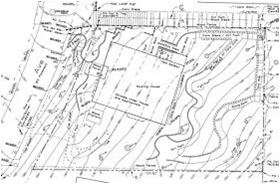
Slope and Topography
The slope and topography of the site will have an impact upon the location of wastewater treatment and disposal systems. It will determine if and where pumping systems are required, and if so, the distance and elevation rise required, which will relate directly to pump size
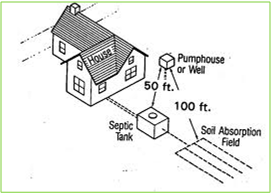
Setbacks between Features
Wastewater system designers must adhere to the required setbacks--the distance between wastewater equipment and buildings, wells, drainages and other features. Check to verify setback compliance for neighboring properties as well.
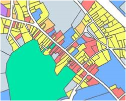
Neighbouring Parcels and Land Use
The land use activities on neighboring parcels may have an impact upon the types of wastewater treatment equipment that is appropriate for a given project. Proximity to residential housing, for example, will determine the level of odor and noise control required.
Drainage
[File:General-considerations 04.png|right|200px]]
Stormwater drainage will impact the location of sewer lines, treatment equipment, and disposal features of the wastewater system. Be sure to plot them accurately on the site plan showing the location and direction of flow.


