File:InfiltrationBasin.jpg
Revision as of 22:11, 28 March 2012 by Winona (talk | contribs) (The aquifer provides water to the coastal towns of Walvis Bay, Swakopmund and Henties Bay, and a large open pit mine at Rössing.)
No higher resolution available.
InfiltrationBasin.jpg (599 × 411 pixels, file size: 281 KB, MIME type: image/jpeg)
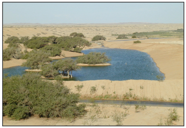
The aquifer provides water to the coastal towns of Walvis Bay, Swakopmund and Henties Bay, and a large open pit mine at Rössing.
File history
Click on a date/time to view the file as it appeared at that time.
| Date/Time | Thumbnail | Dimensions | User | Comment | |
|---|---|---|---|---|---|
| current | 22:11, 28 March 2012 | | 599 × 411 (281 KB) | Winona (talk | contribs) | The aquifer provides water to the coastal towns of Walvis Bay, Swakopmund and Henties Bay, and a large open pit mine at Rössing. |
- You cannot overwrite this file.
