File:Gap analysis planning tools in Indonesia.png
From Akvopedia
No higher resolution available.
Gap_analysis_planning_tools_in_Indonesia.png (529 × 353 pixels, file size: 98 KB, MIME type: image/png)
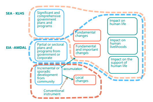
Figure on Gap analysis planning tools in Indonesia taken from Final content report Integrated Coastal Zone Management for the Central Java Province
File history
Click on a date/time to view the file as it appeared at that time.
| Date/Time | Thumbnail | Dimensions | User | Comment | |
|---|---|---|---|---|---|
| current | 05:01, 29 September 2021 | | 529 × 353 (98 KB) | Ima (talk | contribs) |
- You cannot overwrite this file.
File usage
The following page links to this file:

